The main use cases, applied across Waypoints, are presented below.
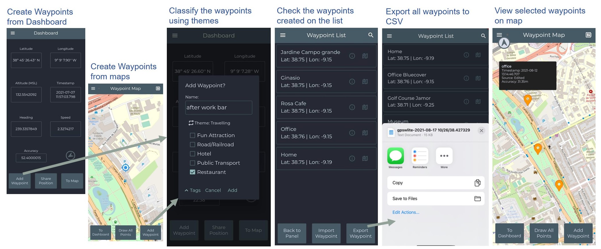
a) Collecting, exporting and viewing Points: this base procedure collects points on the field and exports them to files in multiple formats.
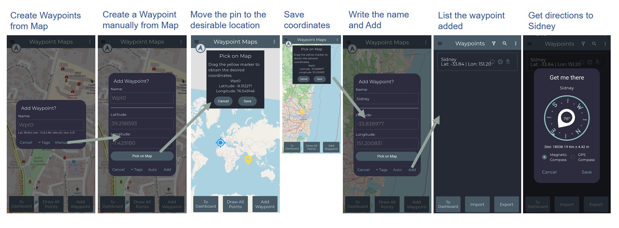
b) Creating Points Manually from Map to Get Directions: the points are created by picking a location on map and get directions to the new point added to database.
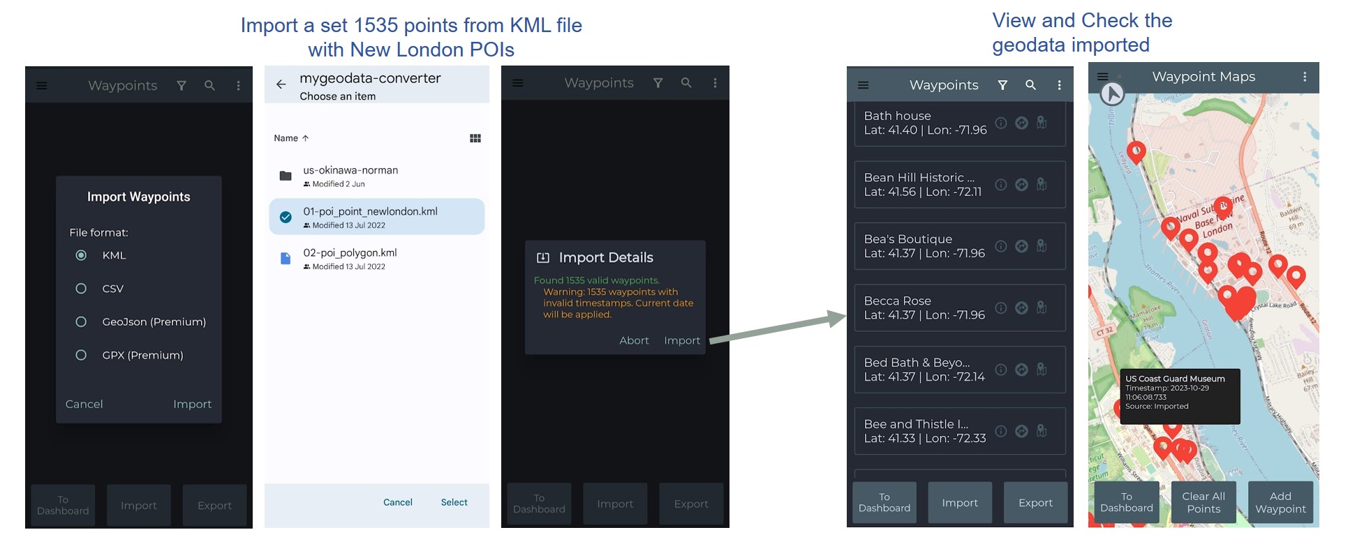
c) Import a set of points: another typical use case is to import data from a survey for exploring and checking it, such as importing New London Points-of-Interest.
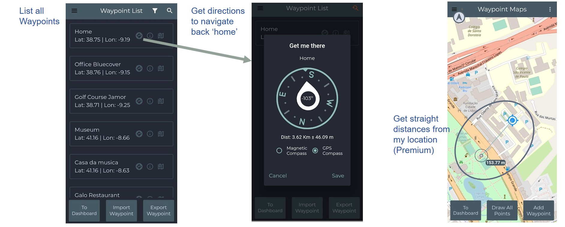
d) Find the way to a Point: it provides the base navigation for finding Points, such as getting direction to go back home. It also provides means to check straight distances from your current location.